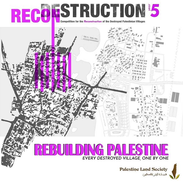
Competition History and Operation - YEAR 5
03 September, 2021
-
Competition for the Reconstruction of Destroyed Palestinian Villages "Year 5" :
/images/vid.png) Event video:
Event video:
-
The Winners of the Competition for the Reconstruction of Destroyed Palestinian Villages "Year 5" are:
First prizes:
This year the the outcome of the jury decision was very similar and pretty much identical when it comes to the first winning project. So, eventually, the jury decided to go with two first prizes for both projects in stead of one winner and the first prize was duplicated (not splitted).
The winner from the University of Petra:
 Lujain Zayed Mahmoud Zayed
, University of Petra (UOP01)
Project: Lubiya Village - Tiberias District
Project description:
The project is a Reconstruction of Lubya village in Palestine, which is one of the villages that were completely destroyed in 1948 because of my belief in the return and my belief that all our displaced villages will return to us one day.
The village is a miniature Palestine that I chose because it is located on the Tiberias-Nazareth road, due to the importance of this road for travelers from the Levant and Turkey to Palestine in the past, so this Lubya constitutes as a gateway to enter Palestine, Also because it was a place of rest for the Saladin army, and there were several battles happened in Lubya, one of them between the lobbiens and the Israeli army, The second is between Crusaders and the Saladin army, who liberated Palestine from the hands of the Crusaders in 1187 .This village has gone through all the stages that Palestine as a whole has gone through, from the occupation of the Crusaders and then the liberation of Salah al-Din and then the occupation of the Israeli army.

In this project I have three targets users: The people of the village who were displaced from it since 1948, and their children and grandchildren, The Palestinian visitors from all over the town and Tourists from outside Palestine to get acquainted with the story of this village especially the difference of the location of the village that it is between the trees so it has many activities for other people if they are from Palestine or from any other place.

Lubya is a Palestinian village 13 kilometers west-southwest of Tiberias, on the road between Tiberias and Nazareth. The displacement of its people in 1948 at the hands of the Israeli occupation. The village’s houses reached 405 in 1931, and the population of the village was 2,350 in 1945. Among the villages closest to it is Nimrin. Lubya is located on a hill overlooking it on a wide plain in the east, located within a depression that takes a northwestern direction between the hill of the mountain, which rises 294 meters above sea level, and the hill on which the village is based. Wheat fields extend in this depression, while olive trees spread north of the village on the mountain slopes. The village rises 325 meters above sea level.
The village’s economy depended on agriculture, and its land was fertile and its wheat was popular in the region. The people of the village relied on raising livestock and beehives.
Lubya was division for ( Al-Hawakeir ) it’s formed for the Palestinian family since ancient times a source of food security, and provided the Palestinian peasant with his daily needs of food.

Through researches and interviews with people who lived in the village, I reached the function that the village had with their places before 1948, Now I will mention each function with how to build it in a way that preserves the heritage with a way suitable for living in 2021 and how the village’s history have been incorporated in my design Also the services, activities and job opportunities that I provide :
1- Like I mention before I have three targets users, an visitors from other villages or from outside Palestine and local people who will live in Lubya who returnees to the village so I provide housing, services, job opportunities for them, The residence of the village was divided into Al-Hawker before 1948, and Al-Hakura is The plot of land connected to housing that it is devoted to the cultivation of vegetables necessary for daily household consumption so I take the concept of Hawakeer but in more private ways to suitable the generation of 2021 and do a community garden in each residential area for the cooperation of individuals in its cultivation and the use of its products to revive the ancient profession of the people of the village, which is agriculture, and to provide self-sufficiency in the farms that they can cultivate.
2- Alkhan that it’s located in the north of Lubya where people coming from the Levant or Turkey used it to rest when they passed the Tiberias-Nazareth road before 1984 so
now I built a new (Khan) but it’s called bed and breakfast for visitors from another villages or from outside Palestine. It’s a comfortable place that the visitor feel likes its home by showing the cooperation in which the people of the village are distinguished, where the owner lives in it and the food provided in it by the people of the village where it is also a job opportunity for the Palestinians, Also this place has three choices for the visitors, they can choose between staying in the building or take a cottage between trees or to camp between trees.
3- Popular market, it is in the center of the village so it has easy access from all sides, whether inside or outside the village, Also it’s Next to the mosque to serve people after prayer and its next to the handicrafts place inside the visitor center to make an easy and close shopping trip and it’s close to Al-Himma which is the widest plain and the most fertile land in the entire district of Tiberias It is located on a plateau about 200 meters above the ground.
4- The mosque is in the middle of the village because it can be accessed from all residential areas by walking and it’s close to shrines (Maqam al-nabi shua’ib and Al-khader as some people said).
5- Public yard, A large yard next to the mosque due to its importance to the Palestinians, where they hold a lot of activities, whether to sell vegetables and some goods, or to sit in it to have lunch.
6- A school: in it’s same place there was a government school for boys it included 135 students, and it established in 1896 during the Ottoman rule, This school continued to perform and its highest class was the fifth grade but now it includes all academic levels for both boys and girls next to the mosque, because the idea of education is directly linked to the old mosque, and the mosque itself can be used as an educational place as well for some classes like before 1948.
7- Healthcare It can be reached from the surrounding villages without having to enter the whole village.
8- A water corridor connects (Byarat Al-Khan) the water well To (Birkat Al-Ajayneh)that it’s lowest point in the village the place where rainwater was collected in the old village, which I revitalized it now.
9- Olive price: From the phrase that was repeated in the mouths of the Palestinians, which says ( we will stay until the olives is here) to confirm that as long as the trees in the village remain and produce olives as long as we have been and are still living on this land.
10- Square includes the names of the martyrs on (Al-Rajum) it’s a land located south of the village a decisive battle took place between the Jews and the Lubya people on it.
11- Shrines: Making a road connecting the shrines (the shrine of the Prophet Shuaib, the shrine of Al-Khidr, and the shrine of the Prophet Shawamin).
12- Visitor center and workshop area for handicraft: its located in the highest area in the village so the visitor can see the whole village who had reconstruction and the trees from the visitor plaza, The visitor center has two ways one of them it’s the beginning of The journey starts from the location of Al-Khan's garden (a well) and ends at (Barakat Al-Ajayneh), one of the largest pools where rainwater collects as is Palestine liberated that is from water to water, which is the basis of mankind as Palestine is for the Palestinians, In the A1 slides I explain every step of this journey, And the other way is go by bridge to walk through the trees especially it’s a village look like a forest so when people come to it they like to walk between trees then they will reach an old cave was from before 1948 with another visitor center for rest and it has cafeteria, reception hall and services.
13- Re-design the settlements in a way that suits the Palestinians and their social relations by merging the houses, removing the bricks and leaving them as alternative roofs.

***********************************************************************************************************************************
The winner from Al Najah University:

Ayman Shakour Bitar, Al Najah University (NJH04)

Motaz Mahmoud Haj Mohammad, Al Najah University (NJH04)

Baha Hasan Qadi, Al Najah University (NJH04)

Zahra Faisal Shraim, Al Najah University (NJH04)

Saad Yousef Yaish, Al Najah University (NJH04)
The Reconstruction of Lubya:
After hearing that Nazareth had fallen and the people of Lubya calling for help with no one to answer, the people had no choice but to flee for safety and thus the Village fell on the 6th of July, 1948 with no fight. This is how the people of Lubya recall the events happening, a memory living throughout the bloodlines of the native Lubyan families, therefore we based our design around the fact that people left the Village with every road where it is, every stone still standing and every thought still in its original space, meaning the people's mental map never once got distorted and bringing them back to where they belong means giving them what they were forced to leave there in the first place 73 years ago.
Our proposal for the reconstruction of the village Lubya was centered around the mental image of the village engraved in its original inhabitants’ minds, as well as,
the new construction of that same mental image in the minds of their children for generations to come, concluded from their elders' stories and what they’ve seen now in the diaspora they currently live in, a somewhat contemporary touch on the original vernacular design of the spaces.The history and culture of the village, as well as, the images, mental maps and memories of the original owners of Lubya were the basis of our design. Starting with the central area -Main Square- of the village keeping it to its original boundaries, while building the network of roads and clusters of homes that existed upon them from the maps, being as faithful as possible to the original trade and travel paths, with some editing to the streets to fit well with the contour taking in consideration the lighting, view and ventilation of the housing units, all heading towards the cultural center of Lubya housing the trio of the (Saha -Main Square-, mosque and school) where people used to gather to trade, pray and connect, made as a reflection to all the "Hawakeer'' that spread throughout Lubya.

After going through the arable lands in the main road to the village you are greeted to the main entrance to a pedestrian only north-south axis with shops on both sides that leads you to the Saha, where you'll find an axis facing the Qibla visually connecting the mosque to the museum mirroring the high religious value of the village as well as the rich history that it has, perpendicular to it, another axis that visually connects the Town Hall to the cultural centre establishing a connection between the people and the cultural heritage that they and the village have. These axises and it's buildings along with a guesthouse, gallery, cafe, and a cemetery all make up the Saha, and along the Southern edge of it we created a low traffic pedestrian road with shops and businesses on both sides which becomes an east-west axis connecting the two sides of the road that circles around the main central area.

And when moving away from the central area of Lubya towards the neighborhoods surrounding it, we made sure the housing clusters integrated well within the nature around it, designing them based on view, privacy and comfort. Achieving that by distributing the units based on contour in regards to the central area, while at the same time providing each cluster with a semi private pedestrian space away from traffic. This space works as a Saha that the owners of the houses would use for relaxing and recreational activities creating a cohesive urban fabric that expands from the centre to all the village.
- In conclusion our Design mainly focused on these topics:
1. Population: We’ve designed the units to accommodate for the growth in population, using two storey traditional houses around the central area, and houses that range
from two to three stories high in the neighborhoods outside of the central area according to the contour.
2. Density: We’ve spreaded out the houses throughout the village, providing each unit with views, ventilation and privacy.
3. Education: We’ve created two separate school buildings one for boys and one for girls, with both having a primary, middle, and high school systems.4. Health: We’ve designed a recreational area west of the village’s centre, and placed a clinic which will fulfill people's medical needs. The area can be easily accessed from the centre. Its high altitude relative to neighboring houses helps provide great ventilation for the clinic and the recreational area.
5. Water: We’ve designed the Saha, houses and buildings of the village with rainwater collecting systems that will help with the daily needs of the buildings, as well as,
direct any overflow to bigger water reservoirs in the ground by taking advantage of the sloping contour, so that it can be used to water the arable lands of Lubya.
6. Roads: We’ve designed roads around the original network of Lubya, making sure that the services were easily accessible, as well as the arable lands being easily reachable by the workers.
7. Historical features: We’ve designed Lubya according to its rich history and culture, making it a recreation of the images, mental maps and memories of its people, everything placed in its original place, so that when the natives come back they can still walk through Lubya based on their own memory of the village.
Religious Sites: We’ve placed the Mosque in its original place, while focusing part of our design upon the Qibla axis as well as reconstructed the religious Maqamat in the village.
Economics: We’ve focused the services and business in the center of the village to make an easily accessible economic and commercial hub for the people of Lubya, as well as visitors from outside the village.
Social Activities:
We’ve designed the Saha at the heart of Lubya as a gathering point for people of the village and visitors.
***********************************************************************************************************************************
The second prize:
 Nour Isam Mujahed
, Al Najah University (NJH01)
Project: Al Walaja Village - Jerusalem District
Al Walaja village:
A Palestinian village located on a large hill on the northern side of Wadi Al-Sarar at an altitude of 750 m above sea level. The village is 5 km away from the city of Bethlehem and 8 km away from Jerusalem. It is surrounded by Beit-Jala city from the eastern side and the villages of Battier and Housan from its southern side.
Al-Walajah village had a population of 15,936, 2,885 of them currently reside in the village, and 13,050 people are in the diaspora. The village has an area of 17,793 dunums, of which only 400 dunams remain, as it was occupied in multiple stages, the major one was in 1948 when 70% of the area of the village was seized. Also, in 1967, an additional 15% of the original land area was taken, and the confiscated land was used to build the two settlements of "Gilo" and "Har Gilo."

The village of Al Walaja is well known in agricultural activities as a primary source of income; the village’s residents exploited the valley by using stone fences to do farming. The occupation turned most of the village’s lands into forests in an attempt to obliterate its identity. Therefore, the rural landscape consisting of agricultural chains is no longer apparent in the occupied part of the village. The project focuses on restoring the original identity of the village by reusing the stone chains as the main item for farming and preserve the existing green areas planted by the occupation.
In terms of planning, two main connecting features were considered. The first one focuses on connecting the center of the village with the lowest point of the valley in the village, where it ends at the old ottoman railroad that passes through Alsekkah valley. The second one links the two hills of the village by using a bridge that passes over the valley.

The first path starts from the original location of the old mosque at the center of the village and passes through the village's public. Commercial and business activities surround this public space. It works as a spot where the village residents could do their different daily goings, such as socializing, shopping, walking, and others. Then, the planned path connects the public square with a fountain where the two springs of Al-Balad and Al-Dolbah pour in. This fountain honors the soul of the martyr Basil Al-Araj, a symbol of resistance for the village. The fountain is used to water the agricultural fields by passing the water through pipes that pass the middle of the stairs located along the farming terrains.

The water in the pipes is distributed to the fields by pumping the water to the stone chains. The endpoint of the watering lines is a pond where water could be aggregated. At the end of this path, a train station is designated based on the concept of old ottoman rail stations. The station’s location is important because it provides an accessible transporting mode for farmers to distribute their agricultural products from the fields. It also could attract the village’s visitors to explore the architecture, nature, and culture of the village. With its identified focal components, this path represents the primary connection between the religious, cultural, social, and agricultural aspects of the village.

The second designated corridor links the two hill parts of the village with a bridge over the valley and the agricultural chains. This corridor starts from the eastern side where the spring of “Ain Al Balad” is located. On this side of the village is planned to have its educational center located at the original site of the old school before the demolition of the village by occupation. Through the bridge, this side is connected with the western hill of the village where the public park and residential united are planned to be. The residential units are distributed in four main areas; each of them represents one of the four prominent families of the village (Wahdan family, Al-Araj family, Al-Hajajila family, Al-Othman family). The design of the residential units simulated the planning of old Palestinian villages. The plan considers privacy by the gradual interchange from the public squares that combine the lanes to the private space, which is the residential yard. The composition of the elements of the second corridor connects the education, residential, and entertaining aspects of the village.
***********************************************************************************************************************************
The third prize:
 Mariam Wahsh
, University Al Quds (AQU01)
 Dina Abu Shamlih
, University Al Quds (AQU01)
Project: Ad Damun Village - Acre District
Revival of the Depopulated Village of Ad-Damun:
What makes a place memorable? Is it activity, rituals and experiences, significance, or design? Is memory associated with the difference between dwelling and building, or is our subconscious constantly looking to connect what our forefathers saw in the past with what we see now?
The relation between Architecture and memory is dialectic. As John Ruskin (1849) said: “we cannot remember without architecture.” Memory also gives architecture a significant meaning, and allows for greater connection between generations. Hence, place becomes more of substance than spectacle, and consolidates the connection with past and nourishes its identity.
Our project is based on reviving the essence of memories that Palestinian refugees of Ad-Damun expressed and aspire to convey to the generations for years to come. These memories obtained through interviews, calls, videos,and research were classified into:
1- Pre-depopulation societal memories of everyday life expressing the customs of the villagers, and their struggles and hardship during and following the Nakba.
2- Spatial memories expressing the prominent places relevant to the people’s stories.
3- Memories of experiences expressing the interactions of Ad-Damun refugees individually and communally from the years before and after depopulation.
Analysis and interventions were based on the revival of this variety of memories mapped on a matrix (see sheet 1 of project) to translate our concept into an architectural design. The spatial interventions were based on the Architecture of memory associated with the good memories of prosperity of pre-Nakba Ad-Damun, the architecture of Dark tourism associated with the painful tragic events leading up to the catastrophic depopulation of the village,and Post-disaster reconstruction architecture for the revival of the whole village.
Urban Plan:
Interventions were based on different spatial scales starting with reviving the historical link between Ad-Damun and Acre city, its significance as the regional “food basket” and provider of light industries, and its original spatial mapping. Planning also aimed to serve the expected inhabitants now and the needs of additional local and international tourists.
The eastern part of Highway-70, where people originally lived, is planned as a multifunctional touristic story-telling central area (المحكى: Al-Mahka) and surrounded with a green buffer zone, followed by the new urban area including housing, public and private spaces. Providing all needed spaces for people to live in Ad-Damun today is balanced with the preservation of green and agricultural lands.
West of Highway-70; the Ad-Damun Plain, along Acre road, a recreation path that included tourist, recreational, historical, as well as light industrial and agricultural stations, was planned. These were based on old important attraction points and the significance of the site which includes the aviation and archaeological stations of Tel Kisan and Ain Daouk, the light industrial area of Ad-Damun and the Na’amin River. The two banks of the river are proposed as a rehabilitated central park. The parks and hotels, services and transportation will support this path and serve its activities. 60% of the area is conserved as agricultural lands upholding this distinct identity of Ad-Damun.
The Spatial Distribution of the Story-Teller (Al-Mahka) area:
Located in old Ad-Damun which encompasses memories of past prosperity; the daily trip to Al-Ain, weddings, occasions, religious tolerance, crafts and products that Ad-Damun villagers had in their homes and more, and the painful memories of the blowing-up of the village followed by expulsion along the path of turmoil and many stations of difficulty and humiliation. The two intertwined memories inform what the Story-teller area communicates.
Thus, the area starts from the still existing main street of Kabul to the east into a distribution area with a visitor's center and a reception area that has two axes:
1- An axis on a higher level representing the painful Nakba memories overlooking the other axis representing pre-Nakba everyday life. This signifies that despite the painful experiences within the first axis, there are always spots of hope for a better life; despite their painful lives, refugees shall always have hope in achieving their right of return. Thus, the first axis begins with a courtyard with a tower that symbolizes the visual and sound experience of the first explosion, and surrounded by scattered concrete monuments presenting information about the 20 Ad-Damun families, their fated places of exile and their martyrs and losses. The tower provides scenery views to Ad-Damun and the whole Story-Teller area. The tower is connected with a bridge that represents the five-month exile path with stations marking the important events that occurred during the exile journey with visual and other sensory effects. The bridge ends with an underground.
.jpg "3-(1).jpg")
2- museum within the hill without fixed exhibits where new generations of Ad-Damun artists can display their work. Museum exhibitions can use lighting from the upper courtyard openings. This is followed by an ascending hill to the woody terraces leading to the
3- landscape with steps connecting with the green areas around old Ad-Damun. These natural areas can be used for sitting and picnics. Another bridge leads to multifunctional cultural buildings within the new urban planned area of Ad-Damun.
.jpg "6-(1).jpg")
4- The other axis is entered from Al-Ain Square, for re-living past events and festivals. Another connected courtyard bears the old memories including the site of the mosque; The first courtyard includes workshop spaces education and practical experiences followed by a playing area. The olive press area wraps around the remains of the old one and then the Hesba (Farmers Market) with Ad-Damun crops and products from the local industries and craft workshop area such as the Akkawi cheese, straw and other artifacts. The restaurant courtyard enhances the sensory experience, such as smell taste and visual texture of Damunian dishes. An area with outer yard facades exhibits the achievements and memories of each family, and followed by a youth club, and a church. The area connects with the hill where the museum provides a meeting point between the two axes.
The old village structure was revived by distributing the courtyards and important sites while factoring construction limitations in our buildings, and the architectural language takes into consideration Ad-Damun architectural imprint.
***********************************************************************************************************************************
Commendation:
Ahmad masalmeh, Birzeit University (BZU01)
Abdulrahman Qutna, Birzeit University (BZU01)
Project: Bayt Jibrin Village - Acre District
Reconstruction, Revival & Development of Bayt Jibrin
Introduction:
Because of the British mandate and the Israeli occupation of Palestine and the wars, displacement and destruction that followed, this led to the destruction of many Palestinian villages and areas, especially in the 1948 Nakba, and the displacement of their residents to different areas inside and outside Palestine.
As a result, we have chosen a theme to revive the destroyed Palestinian villages, in order to shed light on these destroyed villages and to make proposals to revive them in the event that the occupation ends, and to give hope to the Palestinian residents displaced from their villages and increase their attachment to their land, and the choice fell on the destroyed village of Bayt Jibrin, Hebron district.
.jpg "1-(2).jpg")
Select The Village:
The village of Bayt Jibrin was chosen for several reasons, the most important of which is its historical position in ancient times, as it was one of the places in which the Canaanites lived, and there are many ancient monuments that indicate the succession of civilizations and religions on it, such as the Roman civilization where there is an existing Roman amphitheater.
Likewise, with regard to its tourist importance, as it has been considered a tourist center since ancient times because of its monuments and beautiful tourist sites, the most important of which are caves, as it is characterized by many different caves.
The village of Beit Jibreen occupies an important geographical and commercial location in Palestine, where before the occupation it was a link between the West Bank and coastal cities such as Ashkelon and Gaza, and this gives it great commercial importance.
.jpg "2-(2).jpg")
Location Of The Village:
The village of Beit Jibrin, before the occupation and displacement, was a link between the city of Hebron, Jerusalem and Ashkelon, which made it an important commercial and tourism importance at that time, after the end of the occupation and the reconstruction, it will be an important commercial and tourist link in Palestine.
The village of Beit Jibreen is one of the villages in the Hebron governorate, which was occupied and destroyed in 1948, as its lands were annexed within the 1948 lands inside the Green Line. The village is located in a very important location along the Green Line that separates the West Bank from the 1948 lands, surrounded by many displaced villages Because of the Nakba in 1948.
Before the occupation and displacement, Beit Jibreen village included a built-up area that included residential buildings and public buildings such as mosques, churches, courts, and schools.
It also included archaeological and historical buildings and sites.
However, the Nakba (1948) caused the demolition and destruction of a large part of these buildings.
.jpg "3-(2).jpg")
Vision:
The general vision includes returning the displaced indigenous population to the village after the end of the occupation, and providing them with suitable residential areas by using more than one housing type according to their needs.
And contribute to the development of tourism in the village due to the important archaeological and historical landmarks in the village, and the establishment of tourist museums in the village in which the most important information and historical relics of the village are presented and its identity documented.
And the development of agriculture in the village that contributes to achieving self-sufficiency and producing food products and industries that depend on agricultural crops to be exported to external regions and cities, which contributes to the prosperity and development of the village economically and socially.
.jpg "4-(1).jpg")
Program:
The village program has been divided so that it includes residential, tourist, agricultural, commercial and industrial areas, and public spaces and determining its percentage from the total village area with an estimated area of each program.
The housing program has been divided into 3 areas, so that they are distributed in the lands of the village and close to the old village area, with the provision of a suitable road network to facilitate movement between them, which constitutes 17%.
As for the agricultural program, it constitutes most of the village’s area of 68%, which is concentrated in a large proportion on the western side of the village because it is the plain areas suitable for agriculture.
The tourism program has been divided into 3 programs and is concentrated in the archaeological areas and caves scattered in the lands of the village in addition to the park located on the western side of the village, which constitutes 9%.
The industrial program includes the presence of an industrial zone in the eastern region of the village, in order to form a suitable location on the main streets and be linked with the agricultural program, which constitutes 1%.
The commercial program is the longitudinal commercial program that extends along the main street that passes through the village, in addition to the local commercial spread in residential and tourist areas, which accounts for 1%.
The public spaces program includes public buildings that serve the public interest of the population and the open spaces scattered in all parts of the village, and constitutes 4%.
.jpg "5-(1).jpg")
Residential Program:
The residential areas program is divided into 3 residential areas distributed in the village lands, so that they are spread out and not concentrated in a specific area, taking into account urban expansion plans around residential areas.
Each residential area contains the pattern of rural construction and urban construction in order to serve the population with their various needs and with a greater proportion of rural housing, as it is the prevailing pattern in Palestine and the Palestinian villages.
Each area can accommodate 8,300 people, 1,250 rural housing units, and 45 urban housing units, and contains public service buildings such as schools, mosques, and shops that serve the area's residents.
The area of the old village is applied in which the pattern of rural housing is applied with the overlapping of the tourism program in this area in order to ensure that this area will be revived throughout the year, as it is the most symbolic and expressive area of the village’s identity for the residents of the village.
Agriculture Program:
The agriculture program is divided into two parts,
the agriculture department in the plain areas in the west of the village, in which grains and vegetables are grown,
and the agriculture department in the slightly higher southern regions, where trees such as olives and citrus are grown.
Agriculture depends on modern technology and techniques to produce high quality agricultural crops.
The resulting agricultural crops are part of it for the benefit of the village residents to achieve self-sufficiency in the village by displaying agricultural products in the public markets in the village.
The other part is linked with the industrial program so that food industries are produced and exported outside the village, which contributes to the economic prosperity of the village.
Tourist Program:
The tourism program has been divided into 3 programs,
the first program includes the area of the old village and settlement, the area of (Tel Sunda Hanna) and (Iraq Al-Mai), this area that includes most of the historical archaeological areas and caves that have been registered in the World Heritage, so that these areas are used as tourism programs It includes museums, various events, walking paths and rest areas. Hostels that serve tourists are provided in this area and accommodate about 1000 people per week.
The second program is the agricultural tourism program, which is mainly related to the agricultural program, whereby small tourist areas are provided in agricultural areas with the aim of strengthening the participatory relationship between the tourist and the farmer.
The third program is concentrated in the park area, west of the village, which contains forests and large trees, so that it is a picnic area that serves the village residents and tourists.
.jpg "6-(2).jpg")