Source: https://forensic-architecture.org/investigation/executions-and-mass-graves-in-tantura-23-may-1948

This investigation is accompanied by a comprehensive report, which supports an ongoing legal initiative by Adalah.

On the night of 22-23 May 1948, one week after the establishment of the State of Israel, the Palestinian fishing village of Tantura was attacked and occupied by the 33rd Battalion of the Alexandroni Brigade, later made part of the Israeli army. Within hours of occupying the village, Israeli forces and intelligence units conducted a systematic massacre of disarmed Palestinian fighters and civilians.

Both the historical record and the testimonies of survivors captured by scholars and filmmakers reference the existence of several mass graves dug in Tantura on the 23rd of May 1948. These graves had been created to hold the bodies of Palestinian civilians and fighters killed during the battle for control of the village, as well as those executed after its occupation.

Commissioned by the Haifa-based legal centre Adalah, Forensic Architecture has spent the past year conducting a comprehensive analysis of the available cartographic, testimonial, and photographic evidence related to the Palestinian village of Tantura before and after the 1948 war, with the aim of:

  1. locating and outlining the original village cemeteries;
  2. identifying and measuring evidence of any additional mass graves [1] visible in the available aerial imagery of the site, dug after the occupation of the village by Israeli forces on 22-23 May 1948;
  3. assessing the possible explanations for the appearance of the additional mass grave(s); and
  4. determining whether there is visual evidence that any of the additional mass grave(s) were at any point in time unearthed and the bodies exhumed and removed.

Using archival maps, photographs and videos (including previous documentary films about the fall of Tantura), aerial photographs and satellite images, village surveys, memory sketches drawn by former residents of Tantura living in exile, an original survey of the village’s remaining buildings, and a ‘situated testimony’ interview with a living survivor of Tantura, we created a model of Tantura—reconstructing a place long since wiped from the contemporary landscape. The model reveals two key sites, which are very likely mass graves from the time of the village’s occupation—one previously unidentified.

Our methodology and findings are detailed in a report that constitutes one element of a historic legal initiative undertaken by Adalah, which seeks to have the sites of mass graves officially recognised and demarcated. As part of our investigation, we also created a platform that hosts a navigable 3D reconstruction of the village of Tantura prior to its occupation and subsequent destruction, within which archival sources are geolocated. This model is accompanied by a map, which shows the locations of the two mass graves—as well as the locations of further suspected mass graves. In the accompanying video, we foreground the voices of survivors, including Adnan Yahya’s, bringing together our research with the testimonies of survivors from the past 75 years. Taken together, the component parts of our investigation demonstrate the ways in which the memory of the land supports the memory of its inhabitants.

We came across no archival photos from 23 May 1948 that explicitly showed the execution of villagers in Tantura. Although we know that there was at least one camera present in the village at the time, such crimes are rarely documented. In extant photographs from 23 May, however, we can discern patterns of behaviour taking place in and around the sites of mass killing that do support the testimonies of Palestinians survivors and Israeli soldiers.

At least three photographs show the separation of women and children from men carried out by Israeli forces.


This systematic gathering and separation of inhabitants, while potentially indicative of a number of other actions—including interrogation or incarceration—is also very often the first step in the carrying out of mass executions.

Indeed, Palestinian and Israeli testimonies have described this gathering and separation as the first phase of action undertaken by Israeli forces after the occupation of the village, in the lead-up to the mass executions.


They took us to the sea, under Eqab al-Yahya’s house. Then they brought us to the outskirts of town, to the cemetery. We sat there waiting for the cars to take us. They packed up the men and took them prisoner and then they started loading up the women, children, and elderly in cars to take them. […] They were bringing the dead on ladders. They would put three or four on top of each other. The men were gathering the martyred. […] On the ladders […] and they’d dump them into the grave. They dug a mass grave for all of them.
—Alsabre Abu Hana, interviewed by Hala Gabriel, Damascus, Syria, 2006

Earthwork 1: A mass grave near the Muslim cemetery

We compared aerial images taken between 1946 and 1949, and observed a few clear disturbances in the landscape’s surface as well as two new features which appear only in the 1949 images. We analysed these earth features, reconstructed them in a 3D model, and located them on a map. The available testimonies from survivors and perpetrators further support our analysis.

The first earth disturbance, E1, is a long and narrow, rectangular, human-made earth mound. It measures approximately 33 metres in length and 3 metres in width. It is parallel to the main road and situated southeast of the main Muslim cemetery.

Tantura_1 - Comparison of the site of E1 between 1947 and 1949 marking the bush and plot lines. (Forensic Architecture, 2023)
Comparison of the site of E1 between 1947 and 1949 marking the bush and plot lines. (Forensic Architecture, 2023)

Using shadow analysis, we produced a 3D model of E1 to understand its characteristics, particularly in relation to its surroundings. Its height, at its peak, is approximately 85 centimetres.

Tantura_2 - 3D model of Earthwork 1 (E1) and its surroundings. (Forensic Architecture, 2023)
3D model of Earthwork 1 (E1) and its surroundings. (Forensic Architecture, 2023)

When the mound is superimposed on the 1947 image, we can see that E1 is located in the northern edge of a field belonging to the Al-Sabbagh family, 5 metres away from and parallel to a tall, thick line of bushes that marks the field’s uppermost border. There are three palm trees 40 metres south of E1.
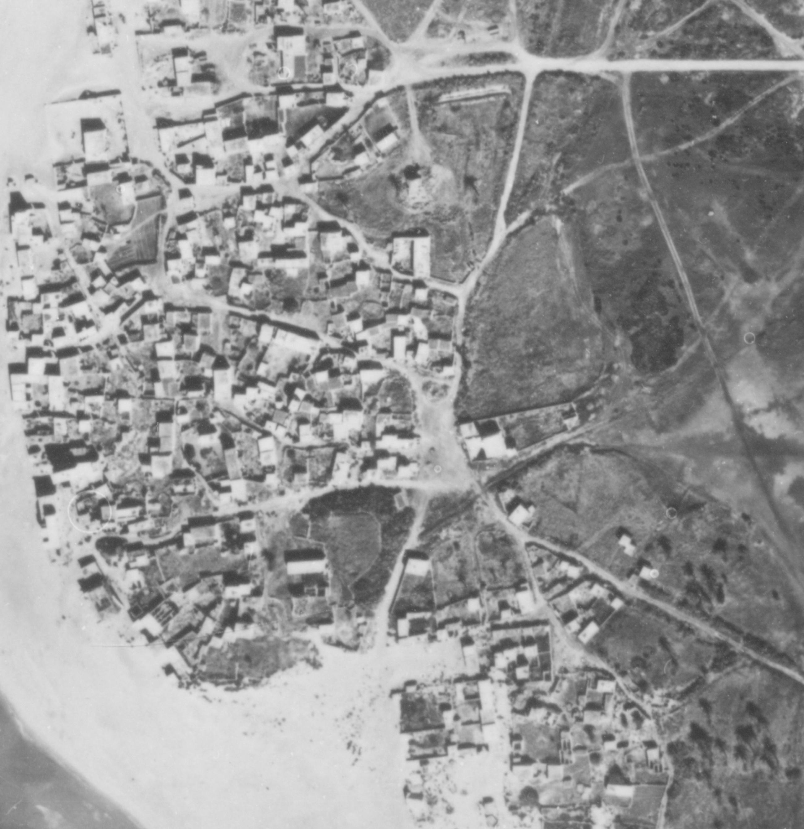
Tantura_3 - IAF 1949 aerial image marking key elements around E1. (Forensic Architecture, 2023)
IAF 1949 aerial image marking key elements around E1. (Forensic Architecture, 2023)

Among the archival imagery we sourced, E1 itself first appears in an aerial image from 25 October 1949. It is our assessment that this image was very likely created in the period that encompassed the occupation, depopulation, and partial destruction of the village, and that E1 is in turn very likely to contain a mass grave where some of the residents of Tantura killed on 22-23 May 1948 would have been buried.

After cross-referencing testimonies of Palestinian and Israeli witnesses, which are collated in our report, we believe that the majority of those buried in this mass grave were people executed after the battle for control of the village.


Until we arrived at the cemetery, there we found a congregation of men and women. From afar we could see people carrying stretchers with dead bodies. About 100-metres away was a huge ditch. They were taking the bodies and dumping them into this ditch. In that moment, the people who were dumping the dead into this ditch, of course, we do not call them dead, we call them martyrs, because all those murdered in Tantura were martyrs. Those same people who carried the dead bodies on stretches to the ditch were killed by a wave of bullets and dumped into that same ditch. That sight, I will never forget. It’s as if I’m seeing it all over again today. From afar, but it was clear that they were taking these stretchers and dumping bodies into that ditch.
—Hussein Ibn Ahmed Ibn Abdel-Rahman Al-Ashmawi (b. 1938), interviewed by Hala Gabriel, Damascus, Syria, 2006


Using a 3D reconstruction of E1, we measured its dimensions and calculated the volume of earth piled above ground level to be approximately 50m3.

The earth removed while digging a grave is often piled beside it, to be used subsequently to cover the bodies. The volume of the earth is thus a function of the number of bodies, taking into consideration the fact that the earth which is piled up over the grave will be less compact and therefore of a lower density.

Tantura_5 - Sectional drawing of E1 showing dimensions of mound and its distance from the cactus bush. (Forensic Architecture, 2023)
Sectional drawing of E1 showing dimensions of mound and its distance from the cactus bush. (Forensic Architecture, 2023)

We believe that if bodies were laid shoulder to shoulder and oriented northwards in a single layer, there could be around seventy bodies under a mound of this size. Were the bodies to be layered on top of each other, as one testimony suggests, the total number could be double that, up to approximately 140 bodies. Thus, our assessment is that the total number of bodies contained in a mass grave site such as this would be in the range of seventy to 140.

Tantura_6 - Marking the rectangular patch above E1 within the IAF 1949 aerial image. (Forensic Architecture, 2023)
Marking the rectangular patch above E1 within the IAF 1949 aerial image. (Forensic Architecture, 2023)

North of E1 is a rectangular patch, which has been the subject of speculation from both historians and filmmakers. We considered the possibility that the digging of the rectangular patch was undertaken between 23 May 1948 and October 1949 so as to remove the buried bodies from the grave, but we believe this scenario to be very unlikely. This patch has semi-regular edges and a lighter colour than the surrounding earth. The shape of this line, uncharacteristically straight, likely indicates the work of the blade of a bulldozer moving along the west-east axis at some point between April 1948 and October 1949. This lighter colour could be attributed to the removal of topsoil and the piling of this earth over the original grave, likely to re-cover bodies which had become exposed, as the landscape in and around Tantura is characterised by a thin topsoil layer.

There have been further claims that the rectangular patch in the 1949 aerial image is in fact an open trench.

To examine this possibility, we constructed an anaglyph image by compositing two perspectives of the same location, where one image is filtered in red and the other in blue. When viewed through corresponding filtered glasses, the resulting 3D effect allows us to determine depth, as each eye processes a different perspective.

GIF of two 1949 aerial images of E1. Source: IAF. (Forensic Architecture, 2023)

Using this technique, our assessment is that this patch has no significant depth, and is thus very unlikely to be a trench, but that it is rather a shallow ‘scratch’ of the surface of the soil, possibly made in the process of piling more earth over the mass grave.

This scenario is also supported by Israeli testimonies describing the buried bodies bloating and becoming exposed to the elements within a week of the mass burial.


After a week I came to Tantura, and where they were buried was a mountain, a great mountain. [….] Mountain. [….] They swelled. [….] Yes. It became a mountain.
—Mordechai Sokoler, interviewed by Theodore Katz, 1997


Traces of E1 persist in the 1952 and 1956 aerial images we sourced. Between 1949 and 1952, the two small shrubs adjacent to E1, as well as the building built near it in the centre of the field and the road leading into it were all removed as the village fell further into ruin and the land was being prepared for the establishment of Jewish settlements on it. 


Tantura_9 - Boundary of Earthwork 1 marked within the IAF 1957 image. (Forensic Architecture, 2023)
Boundary of Earthwork 1 marked within the IAF 1957 image. (Forensic Architecture, 2023)
Tantura_9 - Boundary of Earthwork 1 marked within the IAF 1957 image. (Forensic Architecture, 2023)
Boundary of Earthwork 1 marked within the IAF 1957 image. (Forensic Architecture, 2023)

By 1957, in an IAF aerial image taken nine years after the occupation of Tantura, the area around E1 was beginning to be significantly transformed. To understand the extent of the landscape changes, we marked the location of E1 on a contemporary satellite image. Today, it is a tourist car park serving Dor Beach.

It is possible that, in this process of flattening the landscape, human remains, or fragments thereof, may have been spread well beyond the area of the earthwork itself.

Tantura_10 - Boundary of Earthwork 1 marked within contemporary satellite image. Source: 7 June 2019, OFEK. (Forensic Architecture, 2023)
Boundary of Earthwork 1 marked within contemporary satellite image. Source: 7 June 2019, OFEK. (Forensic Architecture, 2023)

Earthwork 2: A mass grave near the village square

Over the years, testimonies of survivors have repeatedly made reference to bodies being buried in a mass grave dug in an open field which belonged to the Dassouki family.


Many people were killed from our village. It was said that between 60 or 70 people were killed, including men, children and women. They were all buried together in the same hole. This hole was in an area called ‘Bustan Al-Dassouki [Dassouki orchard]. It was a big hole, where they placed all the bodies then covered it up with dirt using bulldozers.
—Fawaz Anis Abu Madi (b.1929) interviewed by Hala Gabriel


Our investigation collated such testimonies from survivors and, in order to understand the layout of Tantura before its occupation, we relied on what we call ‘memory sketches’. These were sourced from a community-populated archive, Palestine Remembered. There, a former inhabitant of Tantura created diagrammatic sketches of village houses drawn from memory, and accompanied them with a legend identifying the families to whom the various building blocks, properties and agricultural fields belonged prior to the occupation of the village in 1948.

Tantura_11 - Memory sketch by Tantura survivor Ahmed Taha Salam identifying property allocations in the village. Source: www.palestineremembered.com.
Memory sketch by Tantura survivor Ahmed Taha Salam identifying property allocations in the village. Source: www.palestineremembered.com.
Tantura_12 - Detail of memory sketch by Tantura survivor Ahmed Taha Salam identifying property allocations in the village. Source: www.palestineremembered.com.
Detail of memory sketch by Tantura survivor Ahmed Taha Salam identifying property allocations in the village. Source: www.palestineremembered.com.

We overlaid the memory sketches on the 1947 aerial image, which allowed us to locate plot 6, a property belonging to members of the Dassouki family, within which the largest field owned by the family is also situated. It is this field which is very likely the location of the mass grave which, as referenced in the testimonies, was dug in order to bury the bodies of those executed following the occupation of Tantura.

On the northern and eastern edges of this field, there is an area that appears to be an orchard. In comparing a 1947 aerial image of the field with a 1949 aerial image, we noticed a distinct feature appear: a human-made earth pile. We refer to this as Earthwork 2, or E2.

Tantura_13a - Boundary of Earthwork 2 in the IAF 1949 image. Above, without marking; below with an outline of the mound and measurements. (Forensic Architecture, 2023)
Boundary of Earthwork 2 in the IAF 1949 image. Above, without marking; below with an outline of the mound and measurements. (Forensic Architecture, 2023)
Tantura_13b - Boundary of Earthwork 2 in the IAF 1949 image. Above, without marking; below with an outline of the mound and measurements. (Forensic Architecture, 2023)
Boundary of Earthwork 2 in the IAF 1949 image. Above, without marking; below with an outline of the mound and measurements. (Forensic Architecture, 2023)
Tantura_14 - 3D model of Earthwork 2 (E2) and its surroundings. (Forensic Architecture, 2023)
3D model of Earthwork 2 (E2) and its surroundings. (Forensic Architecture, 2023)

Using shadow analysis, we reconstructed E2 in 3D so as to study its height and characteristics. This allowed us to calculate the volume of the earth mound, determining it to be roughly 20m3.

Significantly, the height of Earthwork 2 is the same as that of Earthwork 1, approximately 85 centimetres at its peak.

Tantura_15 - Comparison of the site of E2 between 1947 RAF and 1949 IAF marking the bush lines. (Forensic Architecture, 2023)
Comparison of the site of E2 between 1947 RAF and 1949 IAF marking the bush lines. (Forensic Architecture, 2023)
 
Tantura_16 - Sectional drawing of E2 showing the dimensions of the mound and its distance from the cactus bush in the 1949 IAF image. (Forensic Architecture, 2023)
Sectional drawing of E2 showing the dimensions of the mound and its distance from the cactus bush in the 1949 IAF image. (Forensic Architecture, 2023)


As we did with Earthwork 1, we used the measurements of the mound to calculate the likely number of bodies which could be buried there. Our assessment is that the total number of bodies in a mass grave of this size is in the range of forty to eighty.

E2 is first visible in an aerial image from 1949. As with E1, we concluded that it was very likely created during the period over which the battle, occupation, depopulation and subsequent destruction of the village occurred. E2 is faintly visible in imagery from 1952, but by 1956 it has been erased from the landscape. When we located E2 in a contemporary satellite image, we found it to be the beginning of a pedestrian promenade leading to Dor Beach.

A possible signature of mass burial

Although E2 is roughly 14 metres shorter than E1, both earthworks share several characteristics. They are:

  1. long and thin earth features of a similar width (roughly 3 metres) and height (roughly 85 centimetres);
  2. oriented along a similar east-west axis; and
  3. similarly located parallel to a line of high vegetation in the northern edge of an otherwise open field, in the relative periphery of the village.

These physical similarities point to a potential consistent modus operandi of mass burial adopted by the Israeli forces. Taken together, the two sites indicate a possible pattern of mass burial within Tantura, but also point to what may be read as a signature of mass burial adopted by perpetrators in other occupied and depopulated villages in Palestine, where recorded testimonies speak to similar mass killings.

Further suspected mass graves

Collating multiple testimonies from both survivors and perpetrators, we noted that several refer to other areas as likely sites of execution and mass burial. Unlike E1 and E2, these sites are hard to visibly locate in existing aerial photographs, their traces existing instead as the memories and oral history recounted by survivors. These testimonies, collected and mapped on aerial images, show the location of at least two further possible sites of mass graves throughout Tantura.


Mass grave by the beach

On two separate occasions, Mostafa al-Masry (b.1935), a Palestinian from Tantura living in Fureidis, gave testimony that indicated the existence of a burial site by a wall near a courtyard behind the large house of Ahmad Haj Yahya. In a 2008 documentary titled Over Their Dead Bodies by filmmaker Arab Loutfi, al-Masry points to the southern point of a 2 metre wall behind the home of Ahmad Haj Yahya, and then in a subsequent report by MBC Group News, points to the northern point of the same wall. Later, in the 2022 documentary Tantura by filmmaker Alon Schwarz, a fisherman named Fouad Hassadieh, resident of Fureidis, recounted finding human bones in the same location.

Tantura_17a - Sites of possible graves near the beach. The blue and red markers indicate Mostafa al-Masry’s testimony of the location of burial given in interviews with MBC and the documentary Over Their Dead Bodies respectively. The green marker indicates Hassadieh’s testimony of the location where bones were discovered. The yellow outline represents a mound that appears in the IAF 1949 image after the battle. Stills from Over Their Dead Bodies (2008) in red and blue, and from Tantura (2022) in green. (Forensic Architecture, 2023)
Sites of possible graves near the beach. The blue and red markers indicate Mostafa al-Masry’s testimony of the location of burial given in interviews with MBC and the documentary Over Their Dead Bodies respectively. The green marker indicates Hassadieh’s testimony of the location where bones were discovered. The yellow outline represents a mound that appears in the IAF 1949 image after the battle. Stills from Over Their Dead Bodies (2008) in red and blue, and from Tantura (2022) in green. (Forensic Architecture, 2023)
 
Tantura_17b - Sites of possible graves near the beach. The blue and red markers indicate Mostafa al-Masry’s testimony of the location of burial given in interviews with MBC and the documentary Over Their Dead Bodies respectively. The green marker indicates Hassadieh’s testimony of the location where bones were discovered. The yellow outline represents a mound that appears in the IAF 1949 image after the battle. Stills from Over Their Dead Bodies (2008) in red and blue, and from Tantura (2022) in green. (Forensic Architecture, 2023)
Sites of possible graves near the beach. The blue and red markers indicate Mostafa al-Masry’s testimony of the location of burial given in interviews with MBC and the documentary Over Their Dead Bodies respectively. The green marker indicates Hassadieh’s testimony of the location where bones were discovered. The yellow outline represents a mound that appears in the IAF 1949 image after the battle. Stills from Over Their Dead Bodies (2008) in red and blue, and from Tantura (2022) in green. (Forensic Architecture, 2023)
 
Tantura_17c - Sites of possible graves near the beach. The blue and red markers indicate Mostafa al-Masry’s testimony of the location of burial given in interviews with MBC and the documentary Over Their Dead Bodies respectively. The green marker indicates Hassadieh’s testimony of the location where bones were discovered. The yellow outline represents a mound that appears in the IAF 1949 image after the battle. Stills from Over Their Dead Bodies (2008) in red and blue, and from Tantura (2022) in green. (Forensic Architecture, 2023)
Sites of possible graves near the beach. The blue and red markers indicate Mostafa al-Masry’s testimony of the location of burial given in interviews with MBC and the documentary Over Their Dead Bodies respectively. The green marker indicates Hassadieh’s testimony of the location where bones were discovered. The yellow outline represents a mound that appears in the IAF 1949 image after the battle. Stills from Over Their Dead Bodies (2008) in red and blue, and from Tantura (2022) in green. (Forensic Architecture, 2023)


Aerial images from 1947, 1949, and 1952 do not reveal distinct ground anomalies in the precise area highlighted by the witnesses. However, using shadow analysis we were able to observe a significant, elevated ground disturbance approximately 25 metres south of the site appearing for the first time in a 1949 aerial image. We consider it likely that this site by the beach is the location of a possible mass grave.

Beach mound anomalies (1947 / 1949) - The white dashed line outlines the area of anomaly. The yellow outline represents an apparent mound that appears in 1949 after the battle. Left: 1947 RAF aerial image. Right: 1949 IAF aerial image. (Forensic Architecture, 2023)
The white dashed line outlines the area of anomaly. The yellow outline represents an apparent mound that appears in 1949 after the battle. Left: 1947 RAF aerial image. Right: 1949 IAF aerial image. (Forensic Architecture, 2023)


Mass graves inside the village cemetery

We conducted a situated testimony with Adnan Yahya (b.1930) in Treysa, Germany on 11 March 2023. Adnan was asked about his experience of the 1948 battle and occupation of Tantura, using our 3D model of the village, geo-located archival images, and printed aerial images from 1947 and 1949 as visual memory aids.

Situated testimony with Adnan - Situated interview with Adnan Yahya, 11 March 2023. (Forensic Architecture, 2023)
Situated interview with Adnan Yahya, 11 March 2023. (Forensic Architecture, 2023)

During the situated testimony, Adnan testified to the following:

  • He was captured by Israeli forces on the beach and made to stay there for several hours, from the morning until the afternoon, at which point he and a friend were led by Israeli soldiers along the beach. After arriving at a known ‘sweet water’ well at the edge of the largest island by Tantura along the shore, he and his friend were led to the east, along a road into the main village cemetery.
  • Adnan was led to the southeastern corner of the cemetery where a circular pit, approximately 2-4 metres by 2-4 metres had been dug, and bodies had been piled up beside it.
  • Adnan did not dig the pit, nor did he carry the bodies to the site. The bodies had been carried to the location by other villagers. He did not know whether the people he buried were killed during battle or executed after the occupation of the village.
  • Adnan had no memory of wells, cacti, or trees in the immediate vicinity of the pit—but was certain it was located within the cemetery itself, as he had a clear memory of individual graves surrounding the pit. The pit was also located near the main east-west road that led to the railway tracks, and towards Adnan’s old school on the other side of the tracks.
  • Adnan and his friend were forced by Israeli soldiers to throw between approximately ten and twenty bodies into the pit. Adnan recounts that one of these bodies was the father of that friend, who was still breathing when they were forced to throw him in.
Tantura_19 - Situated interview with Adnan Yahya, 11 March 2023. (Forensic Architecture, 2023)
Situated interview with Adnan Yahya, 11 March 2023. (Forensic Architecture, 2023)

Adnan’s testimony regarding the existence of a mass grave inside the cemetery corroborates existing testimonies from other Palestinian witnesses. In Over Their Dead Bodies, while in-person at on the former Tantura site, al-Masry points in the direction of a particular execution site and mass grave; in another segment of the film, a different Tantura survivor, Nayed Sallam, indicates the location of a mass grave site within an archival image of Tantura from 23 May 1948. By geolocating the site and the image within our 3D model, we can confirm that they both point to the existence of a mass grave site located within the boundaries of the village’s main cemetery.

Tantura_20 - Diagram representing all locations testified to be sites of mass graves inside the main cemetery in the village of Tantura, sketched over an aerial image of the surrounding area. Image source: IAF, 1949. (Forensic Architecture, 2023)
Diagram representing all locations testified to be sites of mass graves inside the main cemetery in the village of Tantura, sketched over an aerial image of the surrounding area. Image source: IAF, 1949. (Forensic Architecture, 2023)
Tantura_21 - Diagram representing all locations testified to be sites of mass graves inside the cemetery, sketched over a contemporary aerial image of the surrounding area. Image source: The Israeli Center for Public Affairs (OFEK), 7 June 2019. (Forensic Architecture, 2023)
Diagram representing all locations testified to be sites of mass graves inside the cemetery, sketched over a contemporary aerial image of the surrounding area. Image source: The Israeli Center for Public Affairs (OFEK), 7 June 2019. (Forensic Architecture, 2023)
Tantura_22 - Two stills from Arab Loutfi’s Over Their Dead Bodies (2008). In still A, Mostafa al-Masry points to an area he describes as the site of a mass grave. In still B, Nayed Sallam points in a photograph to the site of a mass grave. Both sites are drawn and labelled above.
Two stills from Arab Loutfi’s Over Their Dead Bodies (2008). In still A, Mostafa al-Masry points to an area he describes as the site of a mass grave. In still B, Nayed Sallam points in a photograph to the site of a mass grave. Both sites are drawn and labelled above.

In comparing the 1947, 1949, and 1952 aerial images, we observed four ground disturbances—each between two and four metres in width and two and four metres in length, in the southeastern part of the main village cemetery, corresponding to the dimensions recollected by Adnan. It is our assessment that there likely exists at least one mass grave located inside the cemetery.

Today, the area consists of a cleared grass patch and a car park serving Dor Beach.

All that remains

Tantura is one of dozens of villages which have a documented record of massacres committed by Zionist and Israeli forces in Palestine between 1947 and 1948. These massacres can be divided according to different typologies, depending on whether they were conducted in villages, towns or cities, and according to whether they took place before the eviction of the population, in order to instigate it, in the killing of unarmed civilians during battle or systematically after the occupation of a locality.[2]

As in other Palestinian villages, the mass graves in Tantura have since been desecrated— destroyed, erased and built over—in a fashion consistent with the systematic targeting of historic Palestinian cemeteries in the country since 1948.

Tantura grave sites - Sites likely and possible mass graves in Tantura marked over contemporary satellite image. Source: 7 June 2019, OFEK. (Forensic Architecture, 2023)
Sites likely and possible mass graves in Tantura marked over contemporary satellite image. Source: 7 June 2019, OFEK. (Forensic Architecture, 2023)

FA’s findings will become part of a historic legal initiative undertaken by Adalah, seeking the official recognition and demarcation of the sites of Palestinian mass graves. These findings, as well as a legal letter prepared by Adalah, were presented at a public screening and panel on 24 May 2023 at the Khashabi Theater in Haifa, alongside testimony from survivors of the massacre.


[1] We understand a ‘mass grave’ to be a ‘burial site containing the remains, often commingled, of numerous persons’, the circumstances of which ‘warrant an investigation as to their lawfulness’. See Special Rapporteur of the Human Rights Council (2020), A/75/384: Report on human rights standards and possible steps towards the respectful and lawful handling of mass graves, 6.

[2] See Jawad, S.A. (2007). “Zionist Massacres: the Creation of the Palestinian Refugee Problem in the 1948 War.” In: Benvenisti, E., Gans, C., Hanafi, S. (eds) Israel and the Palestinian Refugees. Beiträge zum ausländischen öffentlichen Recht und Völkerrecht, vol 189. Springer, Berlin, Heidelberg. According to Jawad, typologies also include “sub-types such as reprisals against whole villages, terror attacks using explosives, aerial bombardments of refugees and forced expulsion that lead to mass fatalities” (p.82).

F